Measure Complex Spaces with Millimeter Precision
Terrestrial LiDAR Scanning in Florida and Alabama
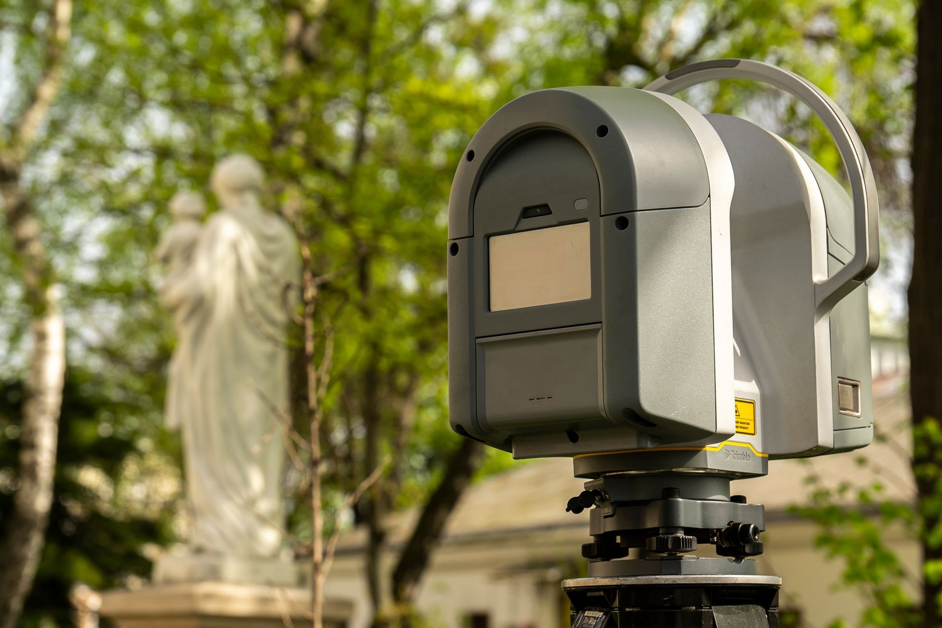
When a site in Jacksonville, Florida, and its surrounding areas, includes structures, tight spaces, or features that cannot be captured from the air, terrestrial LiDAR scanning uses ground-based lasers to record every visible surface. You get a dense point cloud that shows walls, ceilings, equipment, and terrain with millimeter-level accuracy. This method is used for as-built documentation, renovation planning, and any project where precise interior or exterior detail is required.
Aerial Metrology & Inspection positions tripod-mounted scanners at multiple locations around your site, capturing overlapping scans that are later registered into a single coordinate system. The scanner emits millions of laser pulses per second, recording the distance and position of each return. You receive a 3D model that can be sectioned, measured, and exported into design software.
If your project in the Jacksonville, Florida area involves structural documentation or complex site geometry, contact us to review access requirements and scanning scope.
What Scanning Captures That Photos Cannot
After scanning is completed at your Jacksonville site, the individual scans are aligned using overlapping common points, to produce a comprehensive point cloud. Once the point cloud is registered together, the data set can then be geo referenced by identifying ground control points within the point cloud data. The data can be viewed, measured, and modeled to produce accurate measurements for construction estimation and quality control verification.
You will notice that walls, pipes, beams, and other features are captured with enough detail to measure clearances, angles, and offsets without returning to the site. The point cloud serves as a digital record that can be referenced throughout design, fabrication, and construction phases. Color data from an integrated camera can be overlaid onto the scan for visual context.
This service works best when the site is accessible and free of heavy obstructions. The scanner requires line of sight to capture surfaces, so areas blocked by equipment or walls may need additional scan positions. It does not capture subsurface features or materials behind opaque surfaces.
Common Questions About Setup and Output
Clients typically want to know how long scanning takes, what they will receive, and how the data fits into their existing project workflow.
What if I need a licensed survey?
We are fully licensed to provide all survey requirements in Florida. Florida Business License Number: LB8710.
Scanning time varies based on the number of rooms, floors, and required detail. A typical commercial interior in Jacksonville and surrounding areas may take a few hours on-site, with processing completed within several days.
Aerial Metrology & Inspection coordinates scanning schedules and data delivery based on your design and construction timeline in Jacksonville, Florida, and its surrounding areas, along with select locations in Alabama. Reach out to confirm site access, scanning scope, and file format needs.
