Capture Terrain Data from Above
Airborne LiDAR Services in Florida and Alabama
When you need to investigate large stretches of land across Jacksonville, Florida, and its surrounding areas, along with select locations in Alabama Airborne , LiDAR delivers high-accuracy elevation data without requiring crews to walk every acre. You receive detailed terrain profiles that capture both vegetation and ground surfaces—even in areas that are difficult to access on foot. This method can cover hundreds of acres in a single flight, making it ideal for projects where timeconstraints and terrain access are limiting factors across Florida and Alabama sites.
Aerial Metrology & Inspection utilizes LiDAR sensors mounted on aircraft to collect millions of elevation points across your site. Laser pulses penetrate tree canopy to record vegetation height and bare-earth elevation, providing datasets that support utility corridor reporting, drainage and terrain modeling, and infrastructure assessments—where precise topographic data directly impacts design and planning decisions.
If you are planning a project in Jacksonville, Florida, and its surrounding areas, along with select locations in Alabama that require accurate elevation data for a large or complex site, contact us to review your coverage area and data requirements.
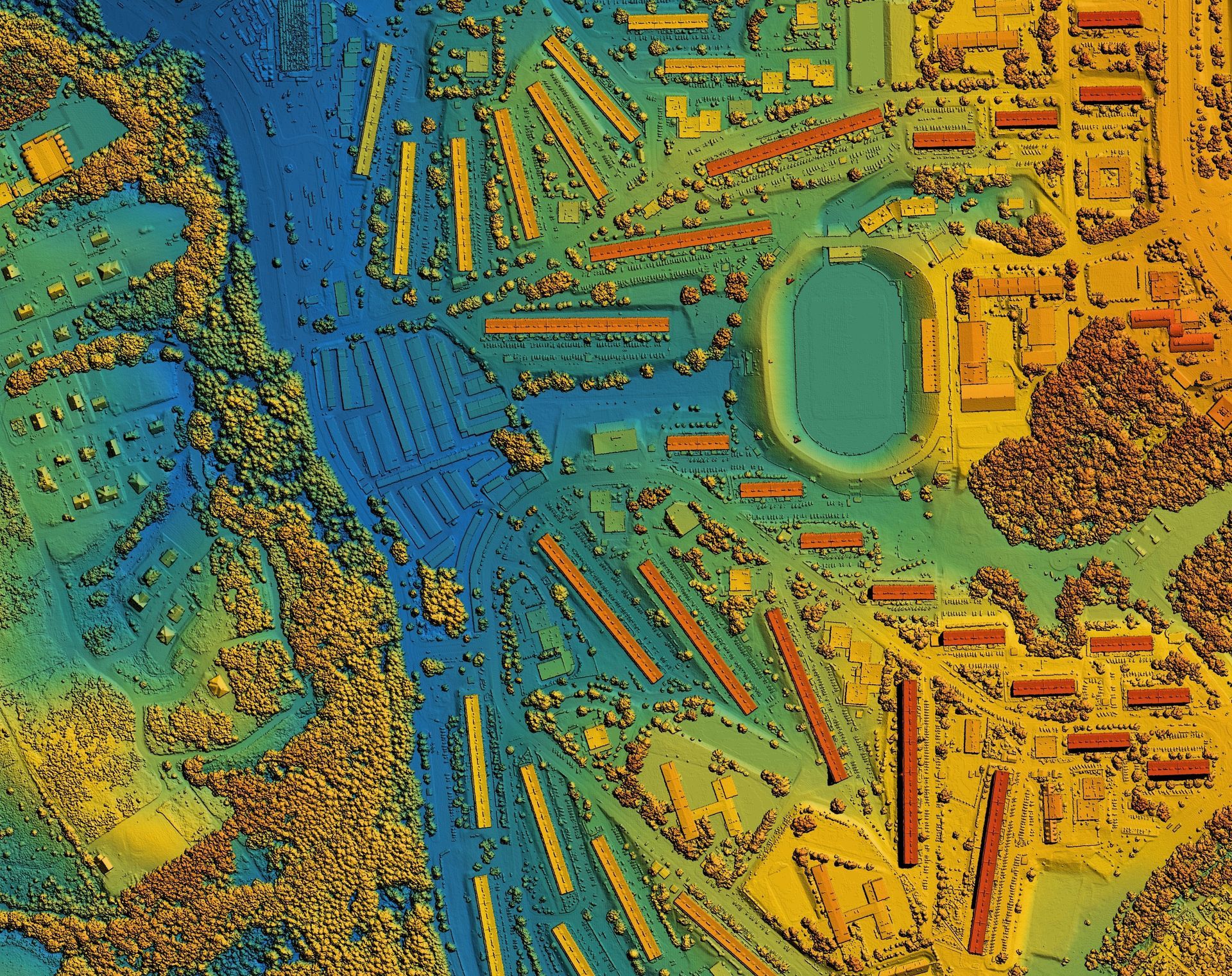
What You Get After the Flight
After the airborne lidar data is collected, over your Jacksonville property, the collected point cloud is processed to remove noise and classify ground versus vegetation returns. From this data set, we provide contours, digital elevation models, and cross-sectional profiles that help you make the best decision for your project. The turnaround depends on site size, but most projects deliver processed data within days of the flight.
You will notice that even heavily wooded areas show accurate ground elevations, which is not possible with standard aerial photography. LiDAR captures the shape of the land beneath dense canopy, giving engineers and surveyors the base data needed for grading plans, flood modeling, and utility corridor routing. The data is spatially referenced and compatible with CAD and GIS software.
The service does not include subsurface investigating or interior structure scanning. It is designed for open-air terrain and infrastructure that can be viewed from above. If your site includes buildings or enclosed areas that require interior detail, terrestrial scanning methods are a better fit and can be combined with airborne data collection.
Questions About Coverage and Accuracy
Most clients want to know how LiDAR handles specific site conditions and what level of detail they can expect before committing to data collection.
What if I need a licensed survey?
We are fully licensed to provide all survey requirements in Florida. Florida Business License Number: LB8710.
Flight time depends on acreage and required point density, but most sites under 500 acres are flown in a few hours. Weather conditions and airspace restrictions can affect scheduling.
It works best for large-area reporting, corridor data collection, and projects where terrain detail is needed quickly across difficult or overgrown sites. Smaller or highly detailed projects may benefit more from terrestrial scanning.
Aerial Metrology & Inspection coordinates flight plans, data processing, and delivery timelines based on your project schedule. Reach out to discuss site boundaries, required accuracy, and file format needs.
